


Lac Jolet

Airelle
User

Length
18.1 km

Max alt
2180 m

Uphill gradient
1108 m
Km-Effort
33 km

Min alt
1195 m

Downhill gradient
1111 m
Boucle
Yes
Creation date :
2021-09-28 07:44:57.0
Updated on :
2021-09-28 15:15:11.653
6h45
Difficulty : Very difficult

FREE GPS app for hiking
 SityTrail
IGN / Geographical institutes
SityTrail Plus
The world is yours!
About
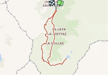
Trail Walking of 18.1 km to be discovered at Auvergne-Rhône-Alpes, Upper Savoy, Les Contamines-Montjoie. This trail is proposed by Airelle.
Positioning
Country:
France
Region :
Auvergne-Rhône-Alpes
Department/Province :
Upper Savoy
Municipality :
Les Contamines-Montjoie
Location:
Unknown
Start:(Dec)
Start:(UTM)
322614 ; 5073805 (32T) N.
Comments